I thought you might like to see our route through this amazing area. Here are some maps:
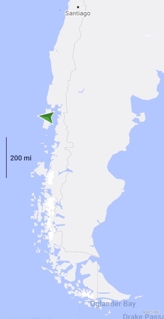
Here is a map of the bottom of South America. The island of Chiloe where I enjoyed the fish lunch etc. is under the green arrow which should of course be pointing downwards as we were travelling south.
The red line on the next map shows our route from this point.
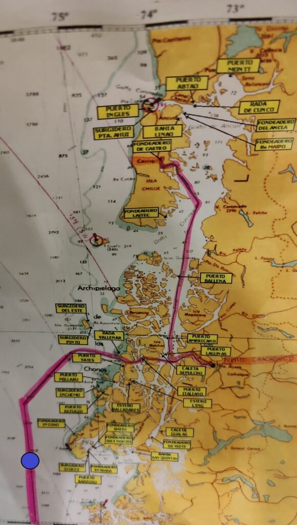
This map shows the start of our journey on Thursday from Castro on the island of Chiloe.
Overnight we sailed south, between the islands, and on Friday morning took a sharp left up a narrow fjord towards Chacabuco (the very small black dot on the map just over half way down).
As we were unable to land, due to the fishing gear obstruction I previously mentioned, we turned and came straight out to the West and into the open sea.
Out of the shelter of the islands, the sea was very rough and through Friday night we had a bumpy ride.
This map follows on from the above but is to a larger scale. The large blue dots are roughly the same position.
The rough sea continued until we reached the shelter of the islands early on Saturday morning.
Continued below.
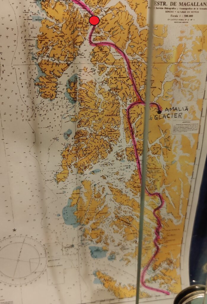
This map is back to the smaller scale. The the red dots are roughly the same position.
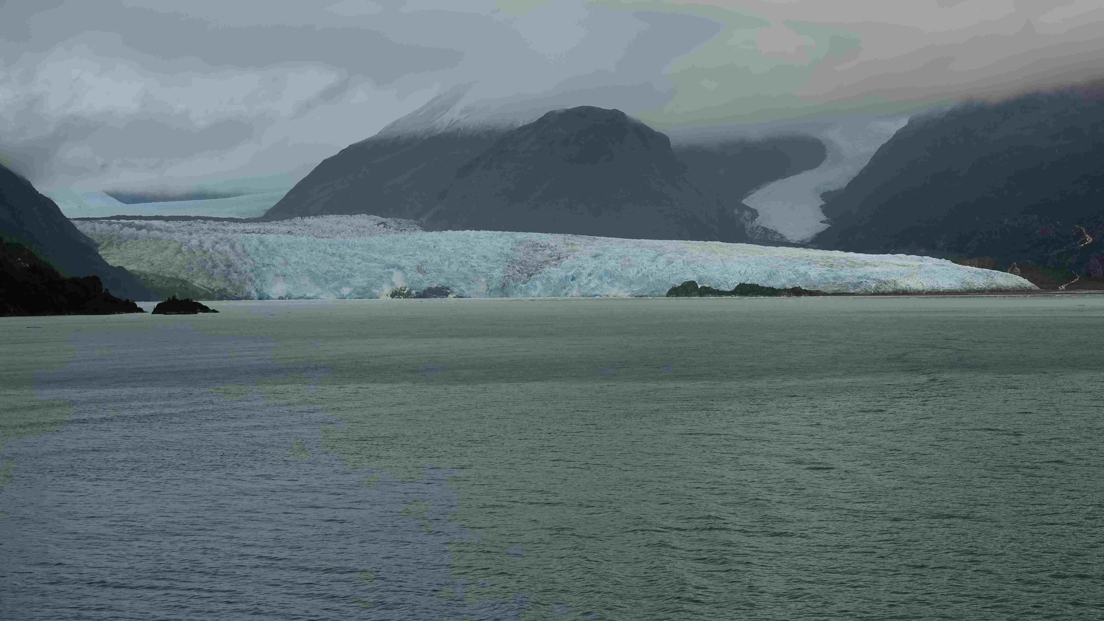
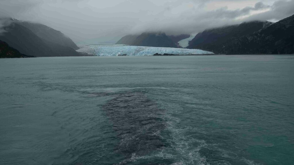
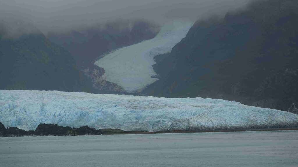
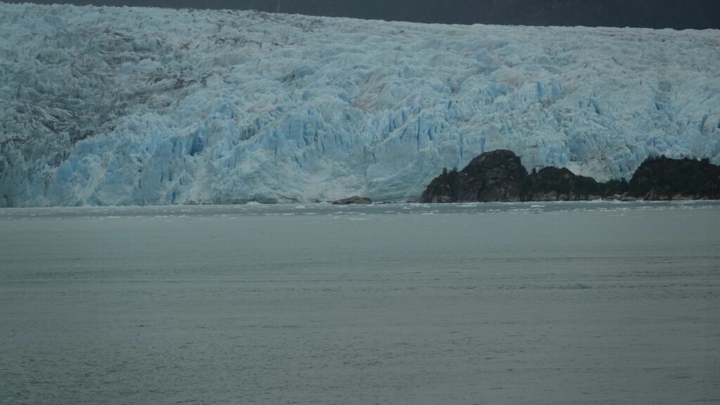
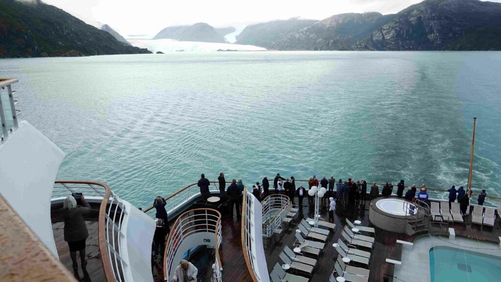
After dinner on Saturday and following a wonderful day, journeying between snow capped mountains, we took a detour to see the Amalia glacier (photos below) and then continued south towards the Magellan Straits just visible at the bottom of this map.
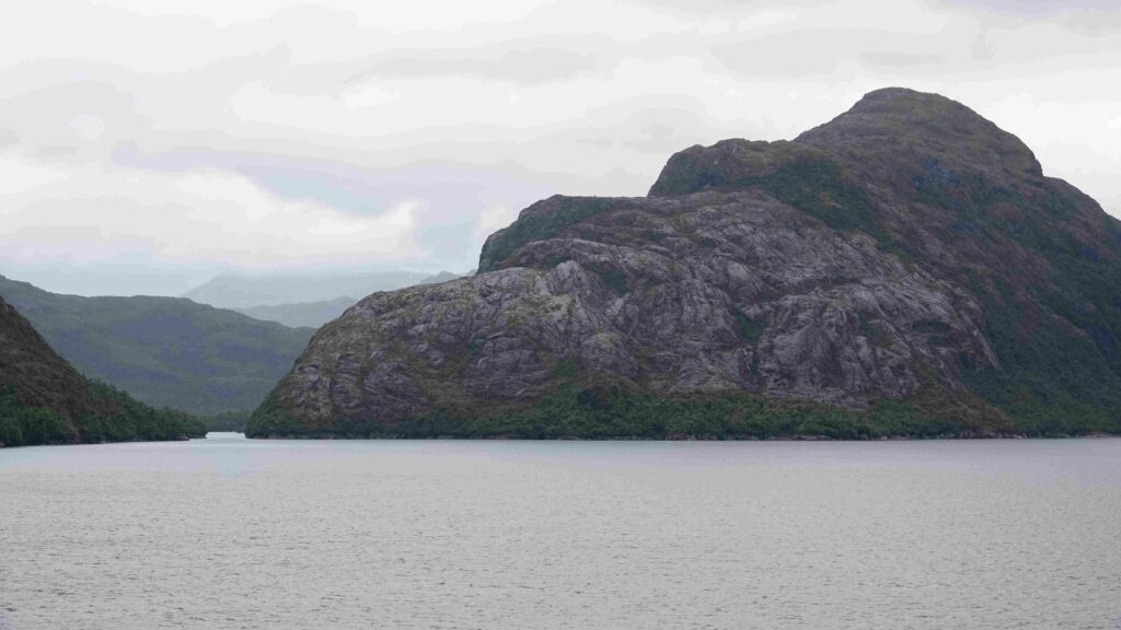
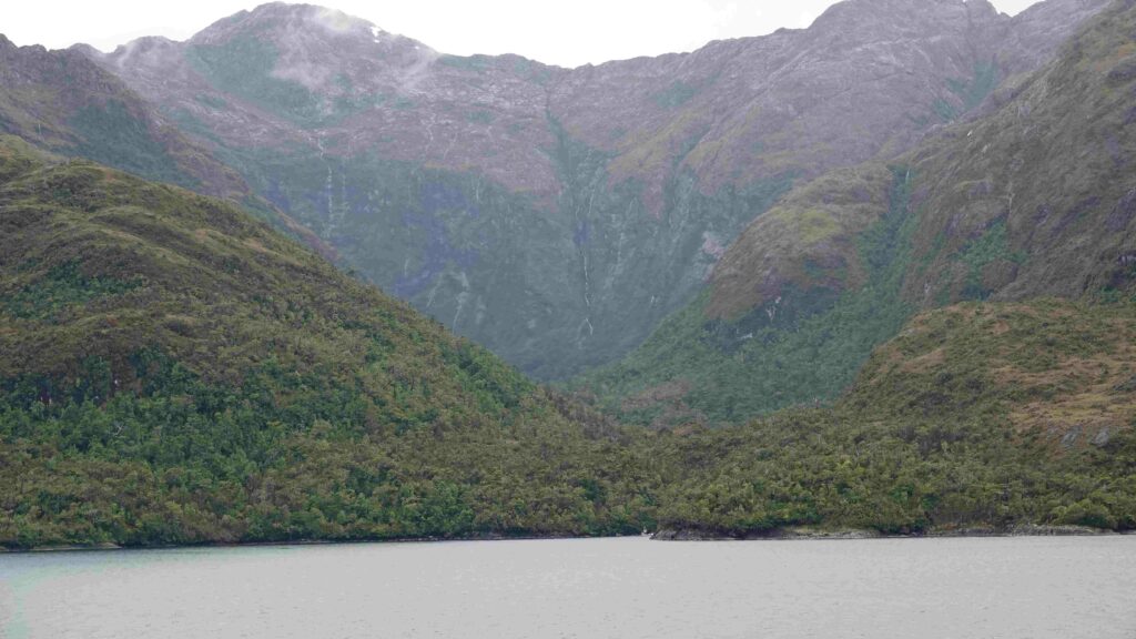
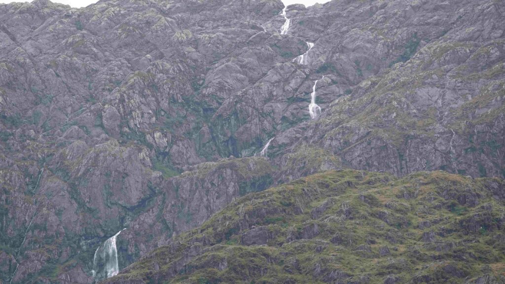
The Amalia Glacier (Saturday Evening)
We continued our journey to Punta Arenas.
Leave a Reply